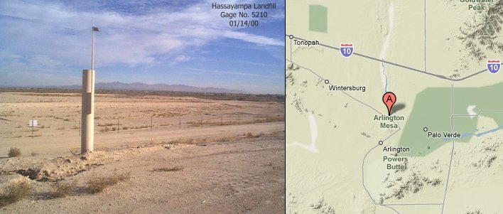
Station Name: Hassayampa Landfill
|
Station ID Number History: |
5210 since installation |
|
Data Begins: |
04/15/1993 |
|
Years of Record: |
9.47 (as of 10/01/02) |
|
Data Repeater: |
White Tank Peak |
|
TRS: |
T1S-R5W-Section 02 |
|
Latitude: |
33° 21' 59" |
|
Longitude: |
112° 44' 33" |
|
Elevation: |
900 ft. msl |
|
Location: |
2 miles Northwest of Hassayampa |
|
Data Record: |
|
|
Partial Months (>10 days missing): |
None |
|
Missing Months: |
None |
|
Remarks: |
Records Good |
Data Statistics for Period of Record:
|
Number of storms greater than 1 inch in 24 hours: |
11 |
|
Number of storms greater than 2 inches in 24 hours: |
1 |
|
Number of storms greater than 3 inches in 24 hours: |
0 |
|
|
|
|
Greatest 15 minute total: |
0.94" on 09/07/02 |
|
Greatest 1 hour total: |
1.54" on 08/08/97 |
|
Greatest 3 hour total: |
1.57" on 08/08/97 |
|
Greatest 6 hour total: |
1.61" on 08/09/97 |
|
Greatest 24 hour total: |
2.24" on 12/26/94 |
Water Year Totals: (Mean of Complete Water
Years [8] = 5.29 inches)
|
Water Year |
Total |
Water Year |
Total |
|
2010 |
|
2000 |
2.76 |
|
2009 |
|
1999 |
5.24 |
|
2008 |
|
1998 |
6.50 |
|
2007 |
|
1997 |
4.49 |
|
2006 |
|
1996 |
M |
|
2005 |
|
1995 |
7.91 |
|
2004 |
|
1994 |
6.10 |
|
2003 |
|
1993 |
M |
|
2002 |
2.91 |
1992 |
|
|
2001 |
6.38 |
1991 |
|
M: One
or more months contain partial or missing data
Click here to
download a .pdf (Adobe Acrobat) file containing all daily rainfall totals for
this station.